01 · ON THE MOVE
During the ride
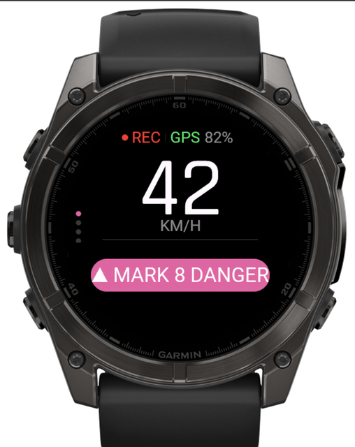
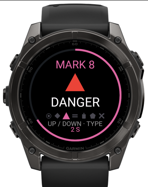
A button on the watch opens a menu of six mark types. The order is always the same, so the right one can be picked without looking. Coordinates, time and the kilometre are recorded for you.
Closed beta · Garmin fēnix 8 and Enduro 3 · iPhone and Android
The Garmin watch records the ride. A button on the watch marks places: a ford, fuel in a village, a tree down across the trail. After the ride, the track and the marks are on the phone. If you ride with others, the map shows every one of them.
How it works
01 · ON THE MOVE
A button on the watch opens a menu of six mark types. The order is always the same, so the right one can be picked without looking. Coordinates, time and the kilometre are recorded for you.
02 · AFTER THE RIDE
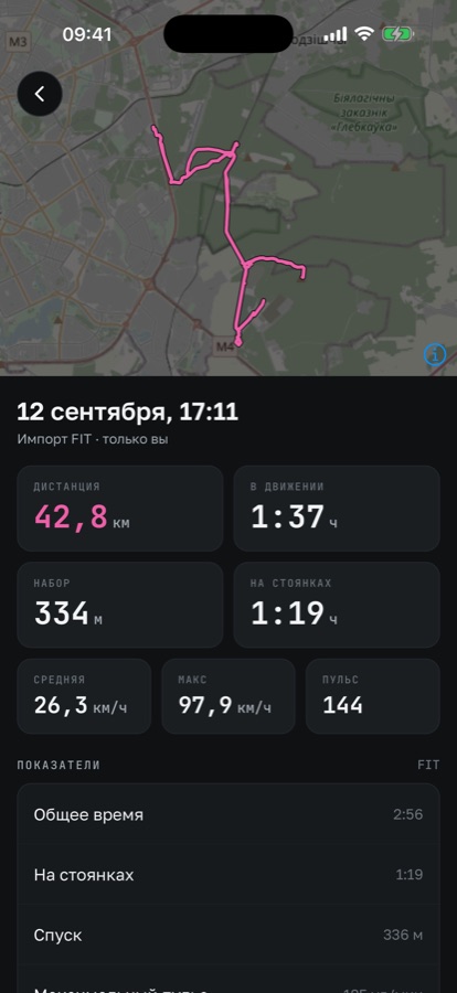
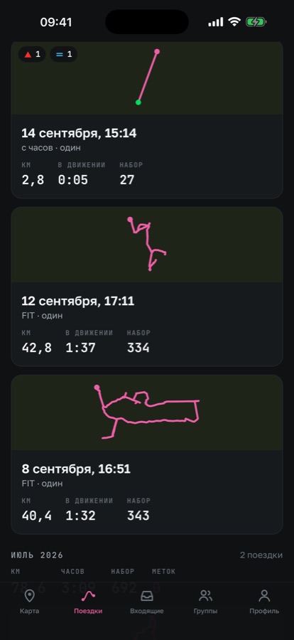
When the watch connects to the phone, the ride shows up in the app: the track, the marks at their kilometres, elevation and heart rate. The marks wait in the Inbox.
03 · IN THE EVENING
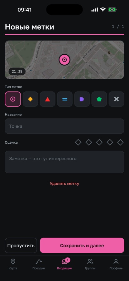
The mark gets a name and a note — “ford knee-deep, hard bottom” — and a rating. After that the spot stays on the map and is still there next season.
Marks on the move
The menu opens with one button and closes with a second press. There is no text entry on the watch: you pick the type only, and the name and the note are added later, on the phone.
Garmin fēnix, 454×454 screen. The same buttons you use in gloves: up, down, confirm.
Group ride
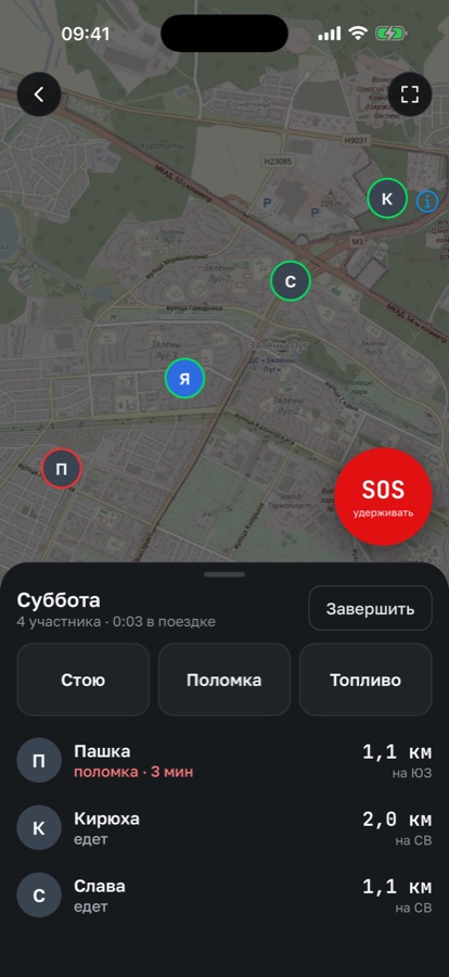
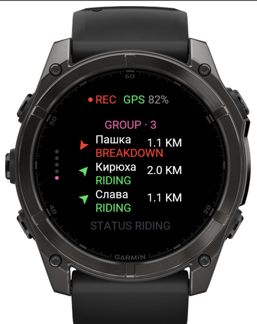
One rider creates the ride, the rest join by link. The map shows where everyone is, their status, and how long a rider has been standing in one place.
SOS
The signal with coordinates goes to the whole group. It works as long as there is cellular coverage.
01
Hold the button for two seconds, then ten seconds to cancel — it will not go out by accident.
02
Everyone in the group gets a buzz on the watch and the coordinates on the map in the phone. You see who it is and at what kilometre.
03
One button — and the rider sees exactly who is coming and how far away they are.
04
Navigation to the point runs on the watch: direction and distance, with no need to take the phone out of your pocket.
The signal goes over the cellular network. If there is no coverage, the coordinates are sent on their own as soon as there is — and they stay with the ride so they can be seen later. This is not a satellite beacon and not a replacement for inReach: it connects you to your group, not to rescue services.
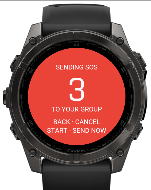
The countdown on the watch. Cancel fills the screen.
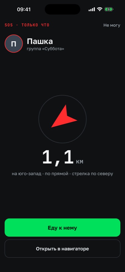
What the rest of the group sees.
Without a watch
A watch makes the app stronger, but it is not the price of entry. With a phone alone the part that matters in a group still works.
Group
Your phone sends its position while the group ride is on. Everyone sees where you are and what your status is.
SOS
The SOS button is in the app too: your coordinates reach the whole group even without a watch.
Recording
A recording screen: the track as you ride it, kilometres, time in motion and the same marks the watch offers. When you finish, the ride lands on the map like any other.
About accuracy. A phone in a pocket records a rougher track than a watch and drains faster — on a long ride you see it. We are not pretending the two are the same. Rides from other apps still come in as FIT and GPX files.
Rides and statistics
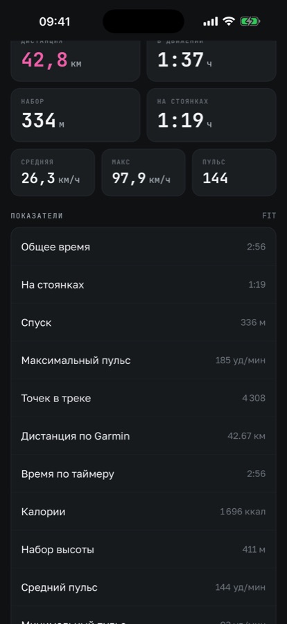
Every ride and every mark sits on one map. Each ride gets distance, elevation gain, moving time and heart rate — the data is taken from the watch, no separate sensor needed.
Distance
128.4km
Gain
1240m
Moving
4:38
Avg HR
132
Your old history moves over as files. Export FIT or GPX from Garmin Connect, add them to the app — the rides take their place on the map with their own dates, tracks and elevation.
How it differs
Garmin's own recording
watch + Garmin Connect
Strava
phone or watch
EnduroCrew
watch + phone + group
We use Garmin and Strava ourselves. EnduroCrew adds two things to them: a typed mark right during the ride, and a group that can see each other on the map.
Privacy
Until you open a particular ride or place yourself. There is no common feed where everything is public by default.
It is shared only during the ride and only with the riders in it. The ride ends — sharing stops.
Not tracks, not places, not contacts. There are no ads and no third-party analytics in the app.
Closed beta
We ride with the app ourselves: recording, marks, group and SOS work on real rides. What matters now is testing it on other routes and other watches — that is where the things you cannot see on your own turn up.